Environmental Study
WisDOT partners with state and federal agencies and non-government organizations to accomplish the transportation mission and meet environmental responsibilities.
Transportation projects are subject to a variety of regulations including but not limited to the National Environmental Policy Act and the Wisconsin Environmental Policy Act.
The I-41 Project Environmental Assessment documented the following elements related to the project:
- The purpose and need for the proposed roadway improvements
- The alternatives WisDOT considered
- The environmental impacts of the alternatives retained for detailed study
- Public involvement and agency coordination efforts
WisDOT approved the environmental assessment, giving agencies and the public the opportunity to review the document and provide comments, including at the public hearings held in July 2021.
The Federal Highway Administration then issued a Finding of No Significant Impact or FONSI documenting the decision, concluding the environmental study process, and allowing the project to proceed to the design phase.
Environmental Study Re-Evaluation Documents


Environmental Study Original Documents


Explore the Interchanges
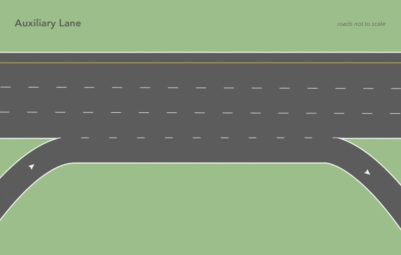
Auxiliary Lane
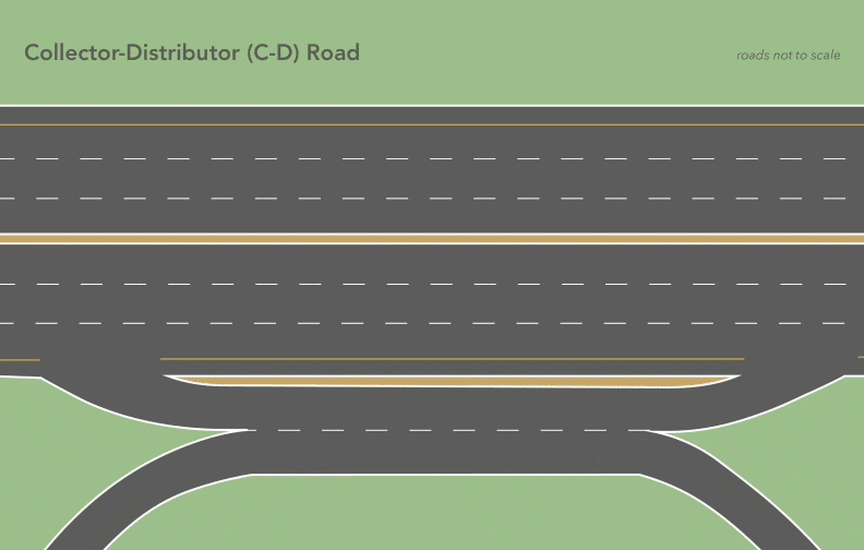
Collector-Distributor (C‑D) Road
Diamond Interchange

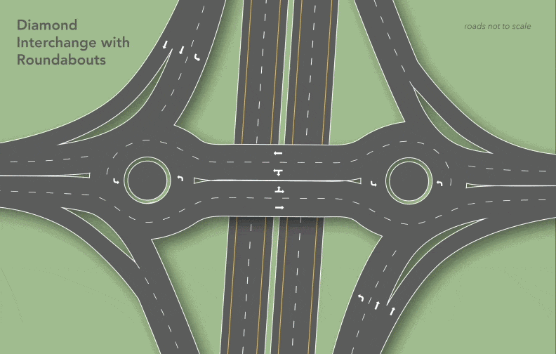
Diamond Interchange with Roundabouts
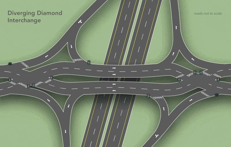
Diverging Diamond Interchange (DDI)
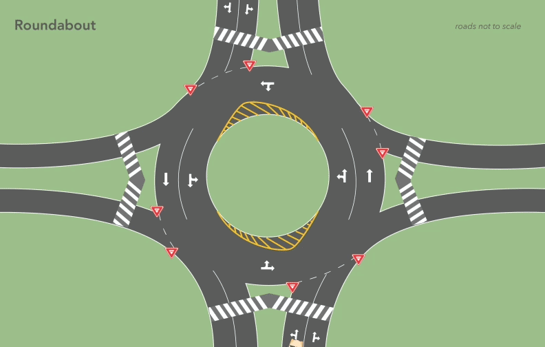
Roundabout
Subscribe, Comment and Attend Virtual Meetings
How to Subscribe for Project Updates
- Click this link: Subscribe
- Enter your city or town of residence, zip code, name and email address
How to Comment on the Project
- Click this link: Comment
- Provide your preferred communication method to receive our response, which we will send in a timely manner, if needed
How to Attend Online Meetings
- Enter your information to register
- Watch the presentation
- Comment and ask questions using the Virtual Podium
Current Job Postings

Real Estate
For additional information regarding your rights as a landowner, see the brochure(s) linked.

.svg)


